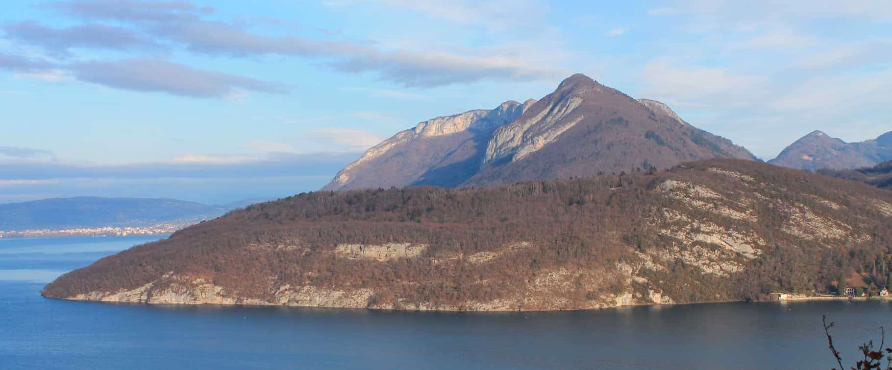
A protected nature reserve
Part of the rocky massif is protected for its ecological importance: the Roc de Chère nature reserve covers almost 70 hectares between Menthon and Talloires, at an altitude of between 450 and 600 meters. It offers sublime views of the mountains and lake. The variety of its flora and fauna makes it a popular destination for wilderness lovers. Attentive walkers will come across remarkable amphibians such as the spotted salamander and the red-legged frog, as well as numerous species of birds and small forest and mountain mammals.
Its flora is predominantly southern in some places, and typically mountainous in others. These contrasts can be explained by the microclimates created by different landforms: from steep limestone slopes to marshy valleys and sandstone ridges. For these reasons, the Chère rock reserve is also of great geological interest.
Thanks to its medium altitude, the Roque de Chère can be explored at any time of year: every season offers its own surprises. As a result, the site is very popular, and visitors are asked to be extremely vigilant in preserving its treasures and leaving no trace of their visit. This is not a nature park, but a nature reserve.
A walk on the Chère rock
For hikers eager to discover the region’s most beautiful landscapes, Le Roc de Cher is an ideal destination. To get to the Roc de Chère from the L’Idéal campsite, just head for Talloires, just 10 km away. Drive through Talloires in the direction of Menthon, and stop at Le Thoron. There is a parking lot at the start of the Roc de Chère trail. This hiking trail takes you directly to the Crête lookout and the Chère rock lookout.
Another pleasant walk in the reserve starts from Menthon, near the Lac d’Annecy golf course. Shortly before the golf course is the Chère rock parking lot. This is where the rural road from Écharvines to Chère begins. A sign at the start of the hike explains the history of the reserve and the characteristics of its flora and fauna. Several itineraries and hiking trails with varying gradients are also available. The lookout path, marked out in green, is the most beautiful. Follow the path as it gently rises through the forest. At each junction, follow your green markers. The first remarkable viewpoint overlooks the bay of Talloires and the château de Duingt. The return journey is then down a slightly steeper slope than the ascent. It passes a second viewpoint, then takes you back to the parking lot along a pleasantly shaded undergrowth path, finally skirting the Lac d’Annecy golf course. These hiking trails are among the most beautiful walks and mountain bike trails in the region. If you’re looking for another hiker’s route, visit the French Hiking Federation website!